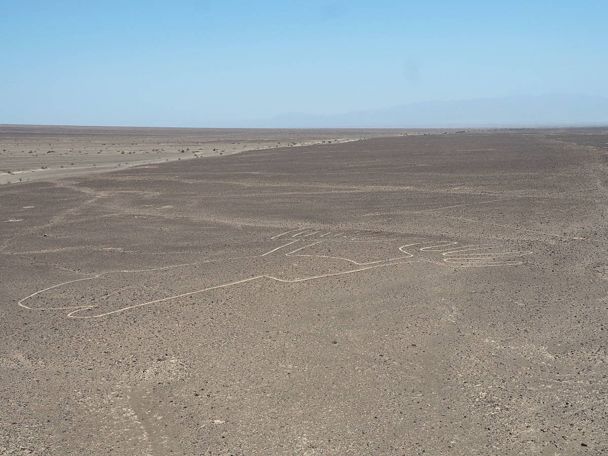
Getting early up in the morning I was planning to head to the famous Nasca lines. I watched many documentaries about the mysterious place and was looking forward to see them finally myself. I was just not sure if I should take a flight or just simply see them myself by climbing up some nearby hills and a 15 m high tower which was just next to the highway.
I decided to skip the flight since I was planning to make some more milage that day and the stop at the tower and a hill gave me a nice overview and a glimpse on how the other lines might look like.
History
“Located in the arid Peruvian coastal plain, some 400 km south of Lima, the Lines and Geoglyphs of Nasca and Pampas de Jumana are one of the most impressive-looking archaeological areas in the world and an extraordinary example of the traditional and millenary magical-religious world of the ancient Pre-Hispanic societies which flourished on the Peruvian south coast between the 8th century BC and the 8th century AD. They are located in the desert plains of the basin river of Rio Grande de Nasca, the archaeological site covers an area of approximately 75,358.47 Ha where for nearly 2,000 uninterrupted years, the region’s ancient inhabitants drew on the arid ground a great variety of thousands of large scale zoomorphic and anthropomorphic figures and lines or sweeps with outstanding geometric precision, transforming the vast land into a highly symbolic, ritual and social cultural landscape that remains until today. They represent a remarkable manifestation of a common religion and social homogeneity that lasted a considerable period of time.
They are the most outstanding group of geoglyphs anywhere in the world and are unmatched in its extent, magnitude, quantity, size, diversity and ancient tradition to any similar work in the world. The concentration and juxtaposition of the lines, as well as their cultural continuity, demonstrate that this was an important and long-lasting activity, lasting approximately one thousand years. Intensive study of the geoglyphs and comparison with other manifestations of contemporary art forms suggests that they can be divided chronologically from the Middle and Late Formative (500 BC – 200 AD) to the Regional Development Period (200 – 500 AD), highlighting the Paracas phase (400 – 200 BC) and the Nasca phase (200 BC – 500 AD). There are two categories of glyphs: the first group is representational, depicting in schematic form a variety of natural forms including animals, birds, insects, and other living creatures and flowers, plants, and trees, deformed or fantastic figures and objects of everyday life. There are very few anthropomorphic figures. The second group comprises the lines, which are generally straight lines that criss-cross certain parts of the pampas in all directions. Some are several kilometres in length and form designs of many different geometrical figures – triangles, spirals, rectangles, wavy lines, etc. Others radiate from a central promontory or encircle it. Yet another group consists of so-called ‘tracks’, which appear to have been laid out to accommodate large numbers of people.” (http://whc.unesco.org/en/list/700)


